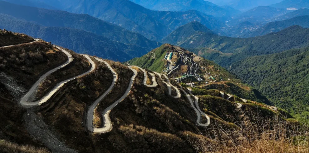
Uttarey Singalila Circuit Trek is a long mountain journey across West Sikkim, starting in Uttarey near the Nepal border and finishing at Yuksom. Instead of turning back after a few days on the Singalila ridge, this route carries on through remote camping country, joins the Dzongri trail and continues to Goechala Viewpoint 1, near 4,600 metres. Our proposed journey takes 17 days, including the arrival and departure days.
The early trail follows the border-side ridge through Chewabhanjyang, Sikkimey Gairi, Dhor and Pare Megu. High lakes and passes lead towards Gomathang and Pangdin. From there, the route meets Dzongri, where the view opens towards Kanchenjunga. Beyond Dzongri, the country changes again: Thansing, Lamuney and Samiti Lake lead towards the close mountain views at Goechala Viewpoint 1.
This is not the shorter Uttarey–Phoktey Dara walk, the Darjeeling Sandakphu trek or a standard Yuksom-to-Goechala trip. It is a demanding point-to-point expedition with many days away from roads. The return follows Kokchurung, takes the connecting trail to Phedang, then descends through Tshoka and Sachen to Yuksom, without climbing back to Dzongri.
Go Wild Expedition arranges trekking journeys from its base in Yuksom. For a circuit this long, the details matter: permits for each section, suitable camps, group food, guide and porter support, and enough time to adjust to the altitude. Share your preferred travel dates, nationality and group size so we can confirm whether the full route is open and prepare a written expedition quote.
Trip Facts
-
Camping at designated sites on the route; village stays as quoted
-
Park and border-route permissions as stated in final quote
-
Uttarey, West Sikkim
-
Late spring or post-monsoon departure, subject to route access
-
Yuksom, West Sikkim
-
According to booking and refund policy
-
Local trekking guide and essential support crew
-
Not included; guests must arrange suitable insurance
-
English, Hindi, Nepali
-
Goechala Viewpoint 1 approx. 4,600 metres
-
Camp meals during agreed trekking days; special diets by request
-
Use refillable bottles and advised water treatment
-
Bank transfer, UPI or cash as agreed before departure
-
Private/group departures after route and permit confirmation
-
Pick-up to Uttarey and drop from Yuksom as quoted
-
Typically 5–8+ hours; several longer days on remote terrain
-
No reliable mobile network or charging for much of the route
-
13
-
65
Uttarey Singalila Circuit Trek Overview
What makes this a different Singalila trek?
Many tours advertised as Singalila treks cover only the shorter ridge walks near Uttarey or the Sandakphu trail near Darjeeling. This package is different. It travels east from Uttarey along the remote Singalila side of West Sikkim, crosses high ground near Danphebhir La, and eventually joins the established Dzongri and Goechala route. It is a continuous journey between two different roadheads, not an out-and-back trek to one viewpoint.
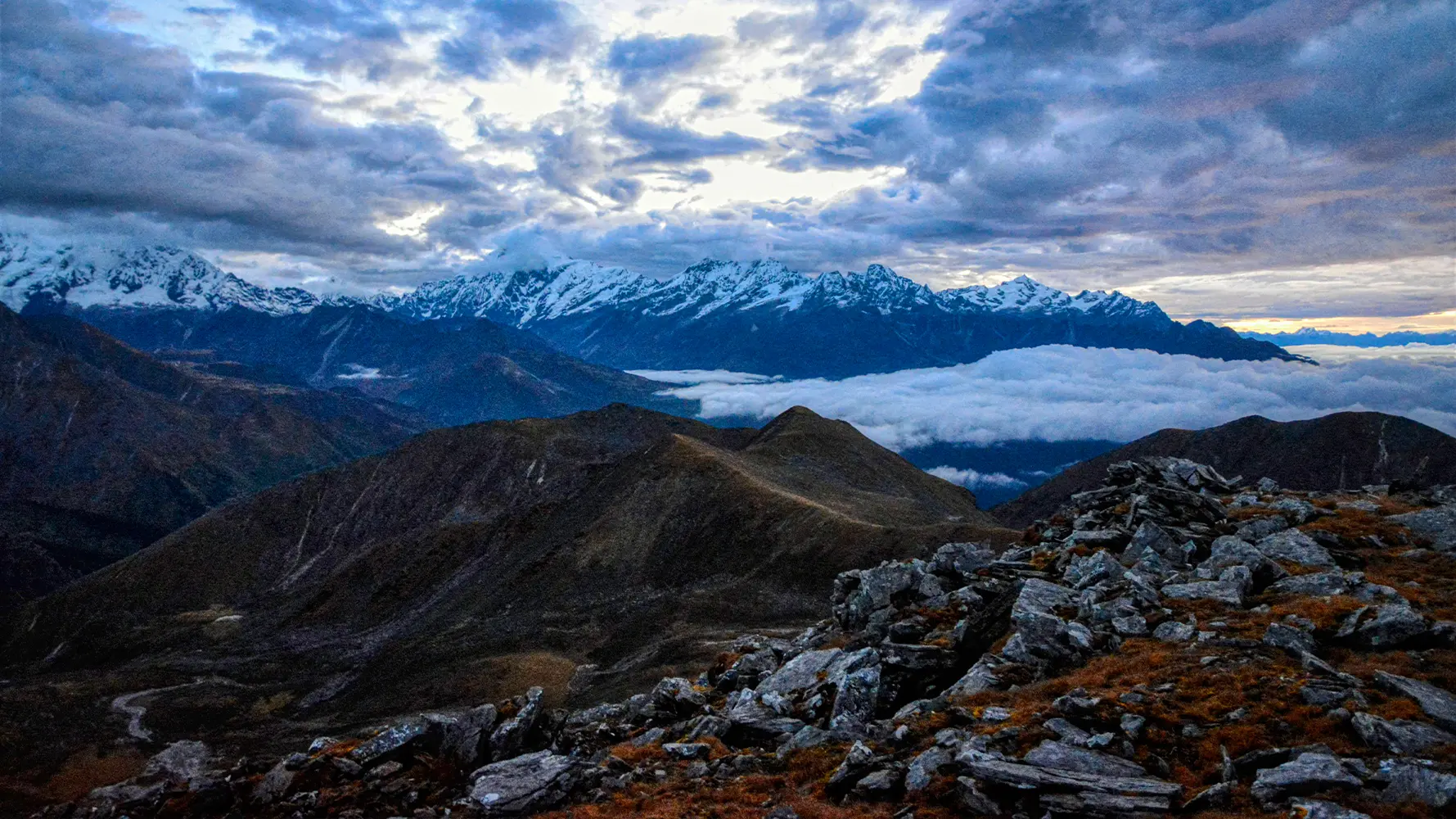
The early days offer a different kind of mountain view. Along the border ridge, you may see distant Everest and Makalu on a clear morning, while Kanchenjunga and its neighbouring summits gradually become the main feature of the skyline. As you move inland, the trail leaves some of its broad ridge views behind and enters valleys with lakes, forest and open grassland. Beyond Dzongri, Mount Pandim stands over the Thansing valley; higher still, the route reaches Samiti Lake and the morning ascent towards Viewpoint 1.
Uttarey to Yuksom: the route in order
Uttarey → Chewabhanjyang → Sikkimey Gairi → Dhor → Pare Megu → Lam Pokhari → Danphebhir La → Gomathang → Pangdin → Dzongri → Kokchurung → Thansing → Lamuney → Samiti Lake → Goechala Viewpoint 1 → Lamuney → Kokchurung → Phedang → Tshoka → Sachen → Yuksom.
This is the proposed route, not a promise that every campsite or ridge crossing will be accessible throughout the year. The Singalila side has more than one trail variation, and particular camping areas and connecting trails must match the permits and approved route for the departure. We confirm the final route with the local trekking team before a booking is accepted.
Is it the same as Singalila National Park?
No. The Singalila ridge runs along the western side of Sikkim and the Nepal border. Singalila National Park is in the Darjeeling district of West Bengal. This expedition uses the West Sikkim ridge route and later joins trekking trails associated with Khangchendzonga National Park. It should not be confused with a standard Sandakphu or Phalut package.
Goechala Viewpoint 1, not the high pass
Some older circuit itineraries still list Goecha La Pass at approximately 4,950 metres as the destination. For a regular trekking departure, we plan to visit Goechala Viewpoint 1, around 4,600 metres. The higher pass lies farther beyond and is not included in this itinerary. Any access to the viewpoint itself depends on the rules, permissions, weather and guide’s judgement at the time of travel.
How difficult is the full circuit?
This is a serious expedition, even for people who have walked to Dzongri or Goechala before. There are many consecutive trekking days, long gaps between settlements and several high sections where wind, snow and mist can change the plan. Some stretches cross rough ridge paths and loose stones. The camp crew must also move food, fuel and equipment over remote ground. There are no convenient road exits along much of the route.
You should have previous experience of multi-day high-altitude trekking and be able to walk uphill for six to eight hours on consecutive days. Some stages may take longer. Strong fitness helps, but it does not prevent altitude sickness. We have kept a day near Chewabhanjyang for gradual adjustment and a second night at Dzongri before the later high camps. If anyone develops concerning symptoms, the guide may cancel a viewpoint excursion or arrange a descent.
Best season for Uttarey Singalila Circuit Trek
The complete route crosses both exposed ridge country and the higher Goechala valley, so conditions in one section may not match the other. Late spring and the post-monsoon autumn window can offer suitable departures when permits, snow conditions and camp access allow. Rhododendrons may flower at lower elevations in spring. Clearer mountain views are often possible after the monsoon, while the nights at high camp become colder.
Do not assume that every month suitable for the shorter Dzongri Trek is suitable for this entire circuit. Heavy monsoon rain can make the forest and ridge trails unsafe, and snow can block passes or high camps. We will confirm the usable trekking dates for the whole route before arranging the group. Our Best Time to Visit Sikkim</a guide explains the wider seasonal differences.
How the itinerary handles acclimatisation
We start the walking journey in Uttarey and stop around Chewabhanjyang before continuing to higher ground. The early ridge days gain and lose height, so the group should not treat easier-looking sections as rest days. After Pangdin, Dzongri offers a familiar camp and time to assess how everyone feels before moving on to Thansing and Lamuney.
The early-morning ascent from Lamuney passes Samiti Lake and reaches Viewpoint 1 only when conditions allow. We then return to Lamuney for food and a short break before continuing down to Kokchurung for the night. On the following day, the return route leads directly from Kokchurung to Phedang and then Tshoka, bypassing Dzongri.
Accommodation, meals and expedition support
Most nights beyond Uttarey are spent in trekking tents at designated camps. Facilities are simple and weather-dependent. The team must plan camp cooking, drinking water treatment and transport of group equipment in advance. Meals are freshly prepared from provisions carried into the mountains, not ordered from a restaurant. Tell us about allergies or dietary needs before the departure is confirmed.
For such a long circuit, the number of guides, cooks, helpers and pack animals or porters depends on the approved group size and route. A headlamp, insulating layers, waterproof clothing, good trekking shoes and a reliable sleeping system are essential. Expect little or no mobile coverage for much of the journey. Do not rely on charging facilities away from roadheads.
Uttarey Singalila Circuit Trek cost and booking
The price of a 17-day supported expedition is not comparable with a short group trek to Dzongri. It depends on the number of travellers, nationality, park charges, available camps, transport, crew requirements, equipment and food for the full crossing. Smaller groups pay more per person because they share the same essential support costs among fewer guests.
Estimated 2026 cost for Indian nationals: From ₹89,500 per person for a group of 6–12 trekkers. For a small private group of 2–5 trekkers, plan for approximately ₹1,19,500 per person. These are higher planning estimates for a fully supported 17-day crossing, not fixed offers that apply to every departure.
The longer route needs food and camp support for more days than a standard Goechala trek. The western ridge also adds remote camps, staff logistics and separate arrival and departure roadheads. A small group must share these costs among fewer travellers, which raises the price per person. A private quote may be higher or lower once the actual crew, camping plan, permissions, dates and transfers are confirmed.
Foreign nationals need a separate quote because permit eligibility, park charges and related arrangements can differ. Before accepting an advance, we will confirm the approved route, services, taxes and the full price in writing. The package prices shown by the booking system are indicative amounts only. Do not assume a quoted price includes road transfers, hotel stays or personal porterage unless these appear in your confirmation.
How this compares with Dzongri and Goechala
Our Dzongri Trek package follows the shorter Yuksom route to the Dzongri ridge and returns the same way. Our Goechala Trek package continues from Dzongri through Thansing and Lamuney to Viewpoint 1 before returning to Yuksom. This Uttarey Singalila circuit adds several remote days on the western ridge before reaching Dzongri and Goechala, which makes it much more demanding in distance, planning and cost.
Enquire before booking: Send us your travel month, group size, citizenship, past high-altitude experience and any transport requirements. We will review route access and provide the detailed expedition plan before confirming a booking. Reaching any specific viewpoint is not guaranteed when weather or health conditions require a change.
Uttarey Singalila Circuit Trek Highlights
- 17-day point-to-point expedition from Uttarey to Yuksom across the western Singalila high ground
- Remote ridge walking through Chewabhanjyang, Sikkimey Gairi, Dhor and Pare Megu
- High lake country around Lam Pokhari and an exposed crossing near Danphebhir La
- Connect to Dzongri through Gomathang and Pangdin instead of turning back on the Singalila ridge
- Two nights at Dzongri, with a possible sunrise walk to Dzongri Top
- Continue beyond Dzongri to Thansing, Lamuney and permitted Goechala Viewpoint 1
- After the viewpoint, camp at Kokchurung and return through Phedang and Tshoka, bypassing Dzongri
- Expedition-style camping with route access, group costs and permits reviewed before booking
Trip Reviews
No reviews yet. Be the first to share your experience!
Share Your Experience
Rate each aspect of your trip and leave your feedback below.